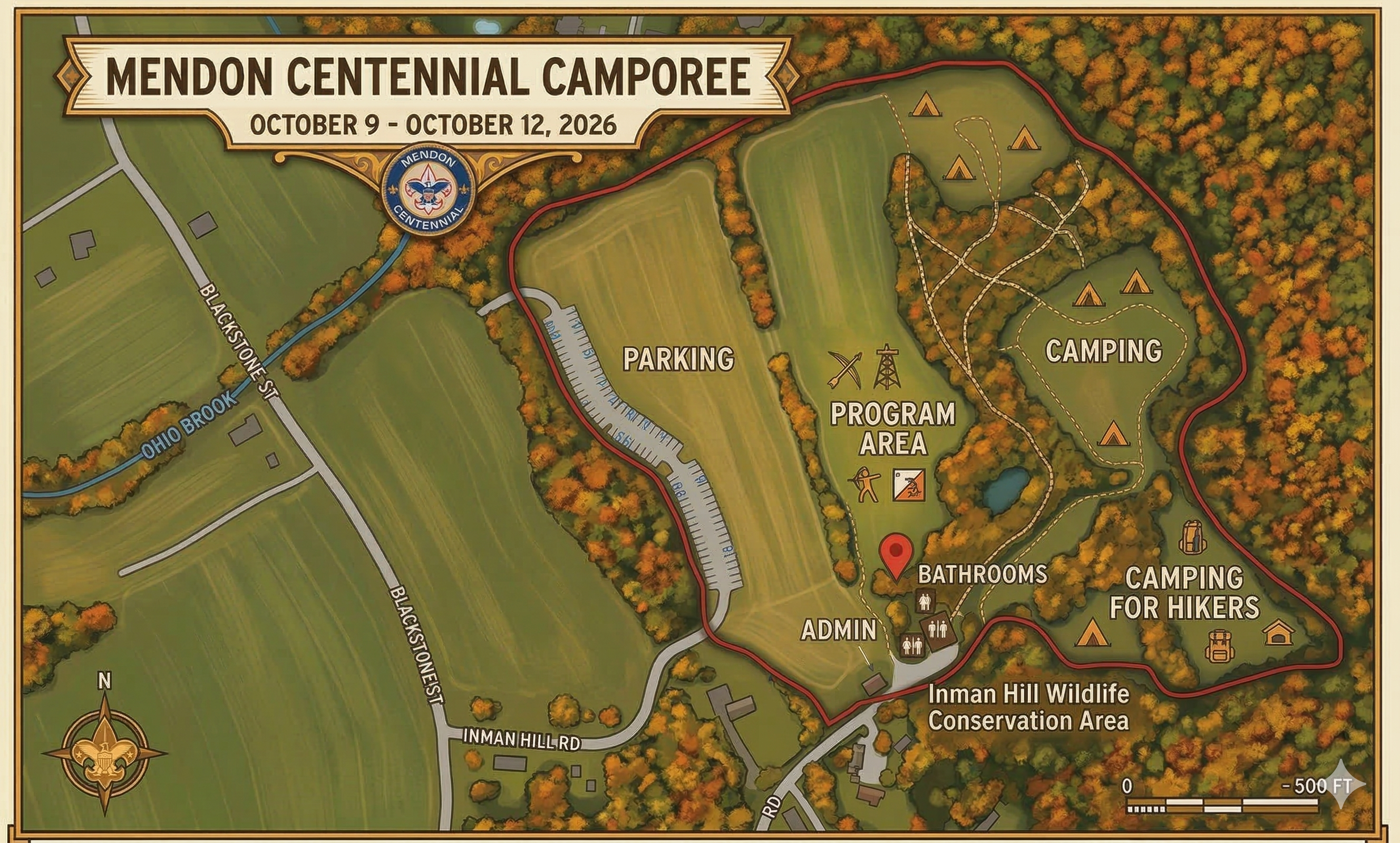
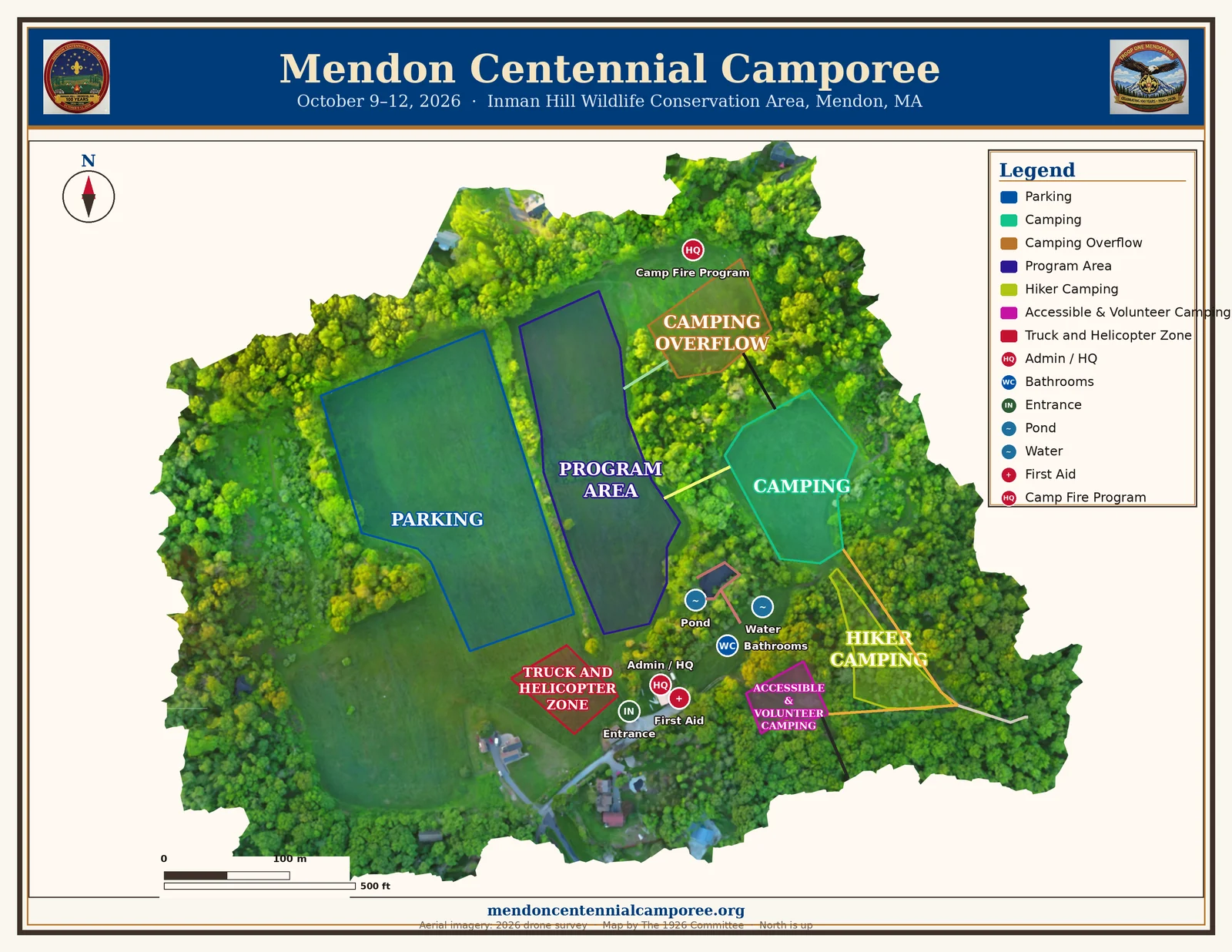
Printable Site Map


Troop 1 Mendon
One place for every view of Inman Hill: the live interactive map with GPS, ready-to-print downloads, and a Map Studio to build your own — all drawn from the same live map data, October 9–12, 2026.
Pan, zoom, and tap any zone or point for details. Use the chips to show just what you need — your choices are remembered on this device. On site, tap the crosshair to see where you are.
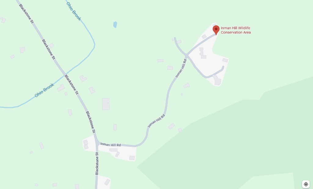
Event parking: 98 Inman Hill Road, Mendon, MA 01756
Tap the crosshair (top-left) to show your location on site. Use the Legend (bottom-right) to find any zone, point, or trail.
Build your own camporee map in seconds: pick a style — aerial photo, heritage parchment, clean print, or night ops — choose what to show, and download or print it. Great for unit handouts, patrol games, camp gateways, and posters.
Loading the Map Studio…
Prefer to grab and go? These are kept in sync with the live map automatically.
Heading out to Inman Hill? Open this site once on your phone before you go — the Camporee App caches the interactive map so it keeps working offline in the field. Event rules and trail guidance live on the Camper Resources page, and there's a printable QR sheet for posting the app, map, and emergency plan around camp.